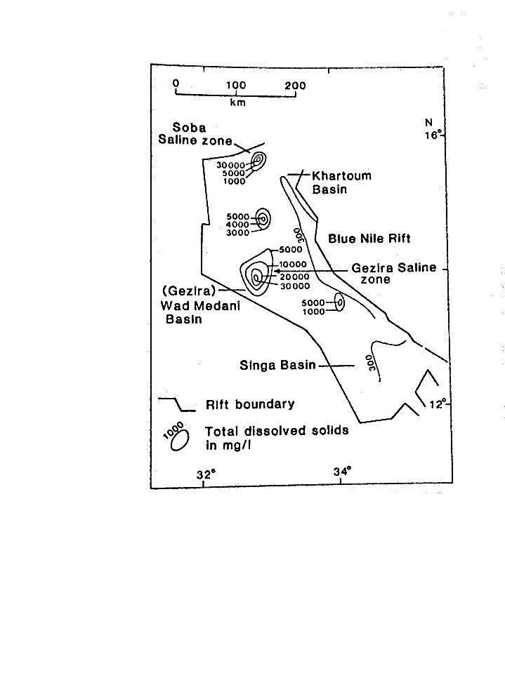

Blue Nile Rift
The Blue Nile rift extends from south of the Sabaloka gorge `The Sixth Cataract' south east to the Sudan borders with Ethiopia , following the Blue Nile, River Rahad and River Dinder. It is formed of three main grabens, from north to south, Khartoum, Wad Medani and Singa, with depth increasing southward. Its southern limit is the elevated Basement block extending in a NW-SE direction with various hills cropping out along this boundary line. The northern margin is another elevated block of basement rocks extending in a NW-SE direction east of River Rahad. A series of fault systems striking NW/SE parallel to the Blue Nile, River Er Rahad and River Dinder having westerly downthrows with southerly increase in depth.
Sediments:
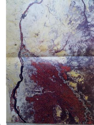
The Blue Nile drains the central and northern part of the high Abyssinian plateau. It is joined in Sudan by the Rahad and Dinder tributaries. The Blue Nile and its tributaries are characterised by a very high suspended sediment load during the flood season of 4000 mg l-1 in August, and 100 mg l-1 during the recession period. The sediments of the Blue Nile are estimated to be 41 million tonnes annually . The sediments filled the Blue Nile rift during the Tertiary and possibly part of the Quaternary epochs. Following the cessation of subsidence and infilling of the grabens and troughs of the Blue Nile rift, sedimentation proceeded to move southward towards the White Nile rift, to fill the Abu Habil trough. The late Pleistocene and Holocene sediments bordering the present Blue Nile between Sennar and Khartoum represent an upward-fining fluviatile sequence. The Holocene alluvium consists of dark, alkaline cracking clays rich in sub-fossil shell fragments; and the late Pleistocene sediments generally comprise current-bedded fine, medium and coarse sand, with extensive outcrops of massive calcium carbonate in bank sections between Hasaheisa and Khartoum, and more localised pockets of water transported volcanic ash".
Gezira Lake:
The area west of Ed Dueim is characterised by the presence of recent sand dunes; below those sand dunes thick layers of evaporites are present which are very similar to the carbonate deposits, near Bahr El Arab. The presence of gypsum and carbonates in the Gezira sediments imply that saline waters accumulated in an internal drainage basin in the past. The presence of massive carbonate deposits or calcrete suggest prolonged and high input of dissolved carbonate under conditions suitable for its precipitation. These were sluggish stream flow and wide dispersal of the water at the down slope end of a fan such as the Gezira. The high salinity zone which is located in Matug trough and roughly coincides with the left branch of the palaeo channel of the Blue Nile forms the Gezira buried saline lake. Using chemical parameters it is postulated that the lake size would fluctuate between a minimum of 250 km2 to a maximum of 15000 km2.
Soba Lake
Salama 1985b showed that Soba lake covers the area extending from south of Sabaloka cataract in the north to the margins of the Khartoum graben in the south. Based on soil and groundwater salinity, the extensive presence of thick late Pleistocene carbonate deposits cropping out in the west bank of the Blue Nile some 5-8 kms upstream of Khartoum, and the presence of saline, alkaline, calcareous, sandy and massive clays sediments in the area between Khartoum and El Masid all indicate that all this area was covered by evaporite deposits. This saline zone also extends northward on both sides of the River Nile, the salinity increasing to very high levels near Sabaloka. During wet periods the main Nile eroded its course in the Sabaloka cataract, the surface water passing through the northern outlet caused the leaching of salts from the top layers. This leaching is more noticeable in the top 10 m of sediments 2 to 5 kms east and west of the Blue Nile areas.